What's new
British Ordnance Collectors Network

This is a sample guest message. Register a free account today to become a member! Once signed in, you'll be able to participate on this site by adding your own topics and posts, as well as connect with other members through your own private inbox!

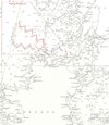
Mine fields Irish Sea

These are the only allied fields laid in that area:
 

Attachments

  • Irish sea_2.JPG
    Irish sea_2.JPG
    125.9 KB · Views: 43
Beaufort’s Dyke has been a munitions dumping area. There has been an explosion in the past which registered as an earthquake, and munitions have washed up on beaches in Scotland and Northern Ireland.
 
Surveyed it a few times using in service UUV's. The threat brief was an eyeopener as to what was down there. Was just wondering if anything other than Admiralty charts was available that may detail boundaries (not that they were stuck to when ditching it at sea)
 
I don’t know about charts, but there is some interesting reading online.


Top